Roeland Park, Kansas
Roeland Park is a city in Johnson County, Kansas, United States. It is part of the Kansas City metropolitan area. In 2010, 6,731 people lived there.[6]
Roeland Park, Kansas | |
|---|---|
 Location within Johnson County and Kansas | |
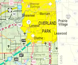 KDOT map of Johnson County (legend) | |
| Coordinates: 39°2′5″N 94°38′21″W | |
| Country | United States |
| State | Kansas |
| County | Johnson |
| Incorporated | 1951 |
| Named for | John Roe |
| Government | |
| • Mayor | Mike Kelly |
| Area | |
| • Total | 1.62 sq mi (4.20 km2) |
| • Land | 1.62 sq mi (4.20 km2) |
| • Water | 0 sq mi (0 km2) |
| Elevation | 988 ft (301 m) |
| Population | |
| • Total | 6,731 |
| • Estimate (2016)[3] | 6,786 |
| • Density | 4,200/sq mi (1,600/km2) |
| Time zone | UTC−6 (CST) |
| • Summer (DST) | UTC−5 (CDT) |
| ZIP codes | 66205 and 66202 |
| Area code | 913 |
| FIPS code | 20-60825 [4] |
| GNIS ID | 0479030 [5] |
| Website | roelandpark.net |
Geography
Roeland Park is at 39°02′05″N 94°38′21″W (39.034705, −94.639211).[7] The United States Census Bureau says that the city has a total area of 1.62 square miles (4.20 km2). All of it land.[1]
People
| Historical population | |||
|---|---|---|---|
| Census | Pop. | %± | |
| 1960 | 8,949 | — | |
| 1970 | 9,760 | 9.1% | |
| 1980 | 7,962 | −18.4% | |
| 1990 | 7,706 | −3.2% | |
| 2000 | 6,817 | −11.5% | |
| 2010 | 6,731 | −1.3% | |
| 2016 (est.) | 6,786 | [3] | 0.8% |
| U.S. Decennial Census | |||
Education
The city is part of the Shawnee Mission School District.
Roesland Elementary School, St. Agnes Elementary School and Bishop Miege High School are in Roeland Park.[8]
References
- "US Gazetteer files 2010". United States Census Bureau. Archived from the original on 2012-07-02. Retrieved 2012-07-06.
- "American FactFinder". United States Census Bureau. Retrieved 2012-07-06.
- "Population and Housing Unit Estimates". Retrieved June 9, 2017.
- "American FactFinder". United States Census Bureau. Retrieved 2008-01-31.
- "US Board on Geographic Names". United States Geological Survey. 2007-10-25. Retrieved 2008-01-31.
- "2010 City Population and Housing Occupancy Status". U.S. Census Bureau. Retrieved August 15, 2012.
- "US Gazetteer files: 2010, 2000, and 1990". United States Census Bureau. 2011-02-12. Retrieved 2011-04-23.
- "SECTION 2 EXISTING CONDITIONS" (PDF). July 17, 2012. Archived from the original (PDF) on March 4, 2016. Retrieved August 18, 2012.
Other websites
- City
- Maps
- Roeland Park City Map, KDOT

This article is issued from Wikipedia. The text is licensed under Creative Commons - Attribution - Sharealike. Additional terms may apply for the media files.