Council Grove, Kansas
Council Grove is a city in Morris County, Kansas, United States.[7] It is also the county seat of Morris County. This city is fifty-five miles southwest of Topeka. It was named after an agreement between European Americans and the Osage Nation about allowing settlers' wagon trains to go through the area to go West. Pioneers came together at a grove of trees so that wagons could stay together for their trip west. In 2010, 2,182 people lived there.[8]
Council Grove, Kansas | |
|---|---|
City and County seat | |
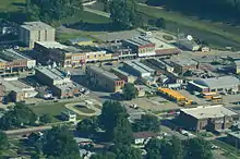
.jpg.webp) Downtown Council Grove (2012) | |
 Location within Morris County and Kansas | |
 KDOT map of Morris County (legend) | |
| Coordinates: 38°39′38″N 96°29′23″W | |
| Country | United States |
| State | Kansas |
| County | Morris |
| Incorporated | 1887 [1] |
| Government | |
| • Type | Mayor–Council |
| • Mayor | Debi Schwerdtfeger |
| Area | |
| • Total | 2.01 sq mi (5.21 km2) |
| • Land | 1.99 sq mi (5.15 km2) |
| • Water | 0.02 sq mi (0.05 km2) |
| Elevation | 1,237 ft (377 m) |
| Population | |
| • Total | 2,182 |
| • Estimate (2016)[4] | 2,060 |
| • Density | 1,100/sq mi (420/km2) |
| Time zone | UTC-6 (CST) |
| • Summer (DST) | UTC-5 (CDT) |
| ZIP codes | 66846, 66873 |
| Area code | 620 |
| FIPS code | 20-15925 [5] |
| GNIS ID | 0477021 [6] |
| Website | cityofcouncilgrove.com |
History


Council Grove was one of the last stops on the Santa Fe Trail when going southwest. The first European-American settler was Seth M. Hays. He came to the area in 1847 to trade with the Kaw tribe. The Kaw had a reservation created in the area in 1846. Hays was a great grandson of Daniel Boone.
On February 26, 1855, a post office was created in Council Grove.[9]
In 1858, the town was officially incorporated by the Kansas legislature.[10] Hays also opened a restaurant in 1857, the Hays House, which is said to be the oldest restaurant west of the Mississippi River.
In 1943, the United States government brought prisoners to Lawrence. These prisoners were war prisoners from World War II. The prisoners were mostly German people and Italian people. The government brought them because farmers needed more people. They were forced to live in camps. These camps were like prisons. Fort Riley created 12 small camps, and one was in Council Grove.[11]
Geography
The United States Census Bureau says that the city has a total area of 2.01 square miles (5.21 km2). Of that, 1.99 square miles (5.15 km2) is land and 0.02 square miles (0.05 km2) is water.[2]
Weather
Council Grove has hot, humid summers and generally mild to cool winters. The Köppen Climate Classification system says that Council Grove has a humid subtropical climate, abbreviated "Cfa" on climate maps.[12]

People
| Historical population | |||
|---|---|---|---|
| Census | Pop. | %± | |
| 1870 | 712 | — | |
| 1880 | 1,042 | 46.3% | |
| 1890 | 2,211 | 112.2% | |
| 1900 | 2,265 | 2.4% | |
| 1910 | 2,545 | 12.4% | |
| 1920 | 2,857 | 12.3% | |
| 1930 | 2,898 | 1.4% | |
| 1940 | 2,875 | −0.8% | |
| 1950 | 2,722 | −5.3% | |
| 1960 | 2,664 | −2.1% | |
| 1970 | 2,403 | −9.8% | |
| 1980 | 2,381 | −0.9% | |
| 1990 | 2,228 | −6.4% | |
| 2000 | 2,321 | 4.2% | |
| 2010 | 2,182 | −6.0% | |
| 2016 (est.) | 2,060 | [4] | −5.6% |
| U.S. Decennial Census | |||
Education


Related pages
References
- "City of Council Grove". The League of Kansas Municipalities. May 27, 2019.
- "US Gazetteer files 2010". United States Census Bureau. Archived from the original on 2012-07-02. Retrieved 2012-07-06.
- "American FactFinder". United States Census Bureau. Retrieved 2012-07-06.
- "Population and Housing Unit Estimates". Retrieved June 9, 2017.
- "American FactFinder". United States Census Bureau. Archived from the original on 2013-09-11. Retrieved 2008-01-31.
- "US Board on Geographic Names". United States Geological Survey. 2007-10-25. Retrieved 2008-01-31.
- "Find a County". National Association of Counties. Archived from the original on 2011-05-31. Retrieved 2011-06-07.
- "2010 City Population and Housing Occupancy Status". U.S. Census Bureau. Archived from the original on July 21, 2011. Retrieved March 6, 2011.
- "Kansas Post Offices, 1828-1961". Kansas Historical Society. Retrieved 15 June 2014.
- History of the State of Kansas: Containing a Full Account of Its Growth from an Uninhabited Territory to a Wealthy and Important State. A. T. Andreas. 1883. p. 803.
- List of Prisoner Of War (POW) Camps in Kansas, Genealogy Tracer
- Climate Summary for Council Grove, Kansas
- USD 417
- Kansas School District Boundary Map Archived July 21, 2011, at the Wayback Machine
More reading
- The Story of Council Grove on the Santa Fe Trail; 2nd Ed; Lalla Maloy Brigham; 176 pages; 1921.
Other websites
- City
- City of Council Grove
- Council Grove - Directory of Public Officials
- Council Grove Chamber of Commerce & Tourism
- Schools
- USD 417, local school district
- USD 417 School District Boundary Map, KDOT
- Historical
- Hays House at YouTube, from Hatteberg's People on KAKE TV news
- Historic Images of Council Grove, Special Photo Collections at Wichita State University Library
- Kansas Photo Tour - Council Grove
- Council Grove 19th Century History
- Historical information about Council Grove
- Maps
- Council Grove City Map, KDOT
