Burlington, Kansas
Burlington is a city in Coffey County, Kansas, United States.[6] It is also the county seat of Coffey County. In 2010, 2,674 people lived there.[7]
Burlington, Kansas | |
|---|---|
City and County seat | |
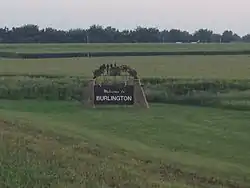 Welcome sign on north side of town (2013) | |
 Location within Coffey County and Kansas | |
 KDOT map of Coffey County (legend) | |
| Coordinates: 38°11′40″N 95°44′44″W | |
| Country | United States |
| State | Kansas |
| County | Coffey |
| Area | |
| • Total | 2.21 sq mi (5.72 km2) |
| • Land | 2.20 sq mi (5.70 km2) |
| • Water | 0.01 sq mi (0.03 km2) |
| Elevation | 1,033 ft (315 m) |
| Population | |
| • Total | 2,674 |
| • Estimate (2016)[3] | 2,610 |
| • Density | 1,200/sq mi (470/km2) |
| Time zone | UTC-6 (Central (CST)) |
| • Summer (DST) | UTC-5 (CDT) |
| ZIP code | 66839 |
| Area code | 620 |
| FIPS code | 20-09400 [4] |
| GNIS feature ID | 0477861 [5] |
| Website | burlingtonkansas.gov |
History
Burlington was created in 1857.[8] It was named after Burlington, Vermont, the native home of one of its creators.[9]
The first post office in Burlington was created in 1858. It was taken from the town of Hampden.[10]
Geography
Burlington is at 38°11′40″N 95°44′44″W (38.194420, -95.745532).[11] The United States Census Bureau says that the city has a total area of 2.21 square miles (5.72 km2). Of that, 2.20 square miles (5.70 km2) is land and 0.01 square miles (0.03 km2) is water.[1]
Climate
Burlington has hot, humid summers and generally mild to cool winters. The Köppen Climate Classification system says that Burlington has a humid subtropical climate, abbreviated "Cfa" on climate maps.[12]
People
| Historical population | |||
|---|---|---|---|
| Census | Pop. | %± | |
| 1860 | 118 | — | |
| 1870 | 960 | 713.6% | |
| 1880 | 2,011 | 109.5% | |
| 1890 | 2,239 | 11.3% | |
| 1900 | 2,418 | 8.0% | |
| 1910 | 2,180 | −9.8% | |
| 1920 | 2,236 | 2.6% | |
| 1930 | 2,273 | 1.7% | |
| 1940 | 2,379 | 4.7% | |
| 1950 | 2,304 | −3.2% | |
| 1960 | 2,113 | −8.3% | |
| 1970 | 2,099 | −0.7% | |
| 1980 | 2,901 | 38.2% | |
| 1990 | 2,735 | −5.7% | |
| 2000 | 2,790 | 2.0% | |
| 2010 | 2,674 | −4.2% | |
| 2016 (est.) | 2,610 | [3] | −2.4% |
| U.S. Decennial Census | |||
Related pages
References
- "US Gazetteer files 2010". United States Census Bureau. Archived from the original on 2012-01-25. Retrieved 2012-07-06.
- "American FactFinder". United States Census Bureau. Retrieved 2012-07-06.
- "Population and Housing Unit Estimates". Retrieved June 9, 2017.
- "American FactFinder". United States Census Bureau. Archived from the original on 2013-09-11. Retrieved 2008-01-31.
- "US Board on Geographic Names". United States Geological Survey. 2007-10-25. Retrieved 2008-01-31.
- "Find a County". National Association of Counties. Archived from the original on 2011-05-31. Retrieved 2011-06-07.
- "2010 City Population and Housing Occupancy Status". U.S. Census Bureau. Archived from the original on July 21, 2011. Retrieved March 6, 2011.
- Kansas State Historical Society (1916). Biennial Report of the Board of Directors of the Kansas State Historical Society. Kansas State Printing Plant. p. 164.
- Blackmar, Frank Wilson (1912). Kansas: A Cyclopedia of State History, Embracing Events, Institutions, Industries, Counties, Cities, Towns, Prominent Persons, Etc. Standard Publishing Company. p. 257. ISBN 9780722249055.
- "Kansas Post Offices, 1828-1961 (archived)". Kansas Historical Society. Archived from the original on October 9, 2013. Retrieved 6 June 2014.
- "US Gazetteer files: 2010, 2000, and 1990". United States Census Bureau. 2011-02-12. Retrieved 2011-04-23.
- Climate Summary for Burlington, Kansas
Other websites
- City
- Schools
- USD 244, local school district
- Maps
- Burlington City Map, KDOT
Municipalities and communities of Coffey County, Kansas, United States | ||
|---|---|---|
| Cities |
|  Map of Kansas highlighting Coffey County |
| Unincorporated communities |
| |
| Townships |
| |
