Amplier
Amplier (French pronunciation: [ɑ̃plije]) is a commune in the Pas-de-Calais department in northern France.[3]
Amplier | |
|---|---|
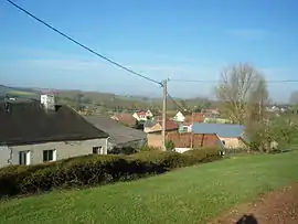 A general view of Amplier | |
 Coat of arms | |
Location of Amplier | |
 Amplier 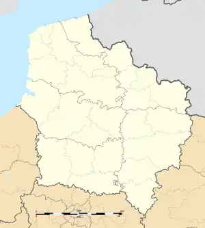 Amplier | |
| Coordinates: 50°08′18″N 2°24′02″E | |
| Country | France |
| Region | Hauts-de-France |
| Department | Pas-de-Calais |
| Arrondissement | Arras |
| Canton | Avesnes-le-Comte |
| Intercommunality | CC Campagnes de l'Artois |
| Government | |
| • Mayor (2020–2026) | Hubert Tassencourt[1] |
| Area 1 | 8.71 km2 (3.36 sq mi) |
| Population (2021)[2] | 304 |
| • Density | 35/km2 (90/sq mi) |
| Time zone | UTC+01:00 (CET) |
| • Summer (DST) | UTC+02:00 (CEST) |
| INSEE/Postal code | 62030 /62760 |
| Elevation | 61–148 m (200–486 ft) (avg. 66 m or 217 ft) |
| 1 French Land Register data, which excludes lakes, ponds, glaciers > 1 km2 (0.386 sq mi or 247 acres) and river estuaries. | |
Geography
A farming village located in the Authie valley (the border with the Somme department), 20 miles (32 km) southwest of Arras, on the D24 road.
Population
| Year | Pop. | ±% p.a. |
|---|---|---|
| 1968 | 273 | — |
| 1975 | 261 | −0.64% |
| 1982 | 230§·→÷×− | — |
| 1990 | 271 | — |
| 1999 | 248 | −0.98% |
| 2009 | 306 | +2.12% |
| 2014 | 308 | +0.13% |
| 2020 | 301 | −0.38% |
| Source: INSEE[4] | ||
Sights
- The church of St. Hilaire, dating from the eighteenth century.
References
- "Répertoire national des élus: les maires". data.gouv.fr, Plateforme ouverte des données publiques françaises (in French). 9 August 2021.
- "Populations légales 2021". The National Institute of Statistics and Economic Studies. 28 December 2023.
- INSEE commune file
- Population en historique depuis 1968, INSEE
Wikimedia Commons has media related to Amplier.
This article is issued from Wikipedia. The text is licensed under Creative Commons - Attribution - Sharealike. Additional terms may apply for the media files.