Boisleux-au-Mont
Boisleux-au-Mont (French pronunciation: [bwalø o mɔ̃]) is a commune in the Pas-de-Calais department in the Hauts-de-France region in northern France.[3]
Boisleux-au-Mont | |
|---|---|
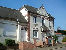 The town hall of Boisleux-au-Mont | |
 Coat of arms | |
Location of Boisleux-au-Mont | |
 Boisleux-au-Mont 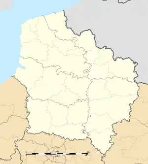 Boisleux-au-Mont | |
| Coordinates: 50°12′39″N 2°46′57″E | |
| Country | France |
| Region | Hauts-de-France |
| Department | Pas-de-Calais |
| Arrondissement | Arras |
| Canton | Arras-3 |
| Intercommunality | CU Arras |
| Government | |
| • Mayor (2020–2026) | Jean-Marie Distinguin[1] |
| Area 1 | 4.66 km2 (1.80 sq mi) |
| Population (2021)[2] | 514 |
| • Density | 110/km2 (290/sq mi) |
| Time zone | UTC+01:00 (CET) |
| • Summer (DST) | UTC+02:00 (CEST) |
| INSEE/Postal code | 62151 /62175 |
| Elevation | 73–108 m (240–354 ft) (avg. 88 m or 289 ft) |
| 1 French Land Register data, which excludes lakes, ponds, glaciers > 1 km2 (0.386 sq mi or 247 acres) and river estuaries. | |
Geography
A farming village located 6 miles (10 km) south of Arras at the junction of the D35 and D36 roads.
Population
| Year | Pop. | ±% p.a. |
|---|---|---|
| 1968 | 395 | — |
| 1975 | 361 | −1.28% |
| 1982 | 409 | +1.80% |
| 1990 | 449 | +1.17% |
| 1999 | 407 | −1.09% |
| 2009 | 497 | +2.02% |
| 2014 | 511 | +0.56% |
| 2020 | 510 | −0.03% |
| Source: INSEE[4] | ||
Sights
- The church of St. Vaast, rebuilt after the destruction of the village during World War I.
- The Commonwealth War Graves Commission cemetery.
References
- "Répertoire national des élus: les maires". data.gouv.fr, Plateforme ouverte des données publiques françaises (in French). 2 December 2020.
- "Populations légales 2021". The National Institute of Statistics and Economic Studies. 28 December 2023.
- INSEE commune file
- Population en historique depuis 1968, INSEE
This article is issued from Wikipedia. The text is licensed under Creative Commons - Attribution - Sharealike. Additional terms may apply for the media files.