Berles-au-Bois
Berles-au-Bois (French pronunciation: [bɛʁl o bwa]) is a commune in the Pas-de-Calais department in the Hauts-de-France region in northern France.[3]
Berles-au-Bois | |
|---|---|
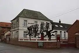 The town hall of Berles-au-Bois | |
 Coat of arms | |
Location of Berles-au-Bois | |
 Berles-au-Bois 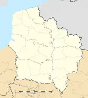 Berles-au-Bois | |
| Coordinates: 50°11′51″N 2°37′48″E | |
| Country | France |
| Region | Hauts-de-France |
| Department | Pas-de-Calais |
| Arrondissement | Arras |
| Canton | Avesnes-le-Comte |
| Intercommunality | CC Campagnes de l'Artois |
| Government | |
| • Mayor (2020–2026) | Michel Petit[1] |
| Area 1 | 8.9 km2 (3.4 sq mi) |
| Population (2021)[2] | 523 |
| • Density | 59/km2 (150/sq mi) |
| Time zone | UTC+01:00 (CET) |
| • Summer (DST) | UTC+02:00 (CEST) |
| INSEE/Postal code | 62112 /62123 |
| Elevation | 105–159 m (344–522 ft) (avg. 102 m or 335 ft) |
| 1 French Land Register data, which excludes lakes, ponds, glaciers > 1 km2 (0.386 sq mi or 247 acres) and river estuaries. | |
Geography
Berles-au-Bois
A farming village located 11 miles (17 km) southwest of Arras on the D62 junction with the D30 road.
Population
| Year | Pop. | ±% p.a. |
|---|---|---|
| 1968 | 557 | — |
| 1975 | 524 | −0.87% |
| 1982 | 531 | +0.19% |
| 1990 | 524 | −0.17% |
| 1999 | 485 | −0.86% |
| 2009 | 506 | +0.42% |
| 2014 | 513 | +0.28% |
| 2020 | 520 | +0.23% |
| Source: INSEE[4] | ||
Sights
- Remains of a 13th-century château.
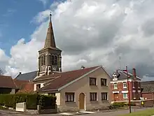
- The church of Saint-Pierre, rebuilt, like most of the village after the ravages of World War I.
- Three World War I cemeteries.
References
- "Répertoire national des élus: les maires". data.gouv.fr, Plateforme ouverte des données publiques françaises (in French). 2 December 2020.
- "Populations légales 2021". The National Institute of Statistics and Economic Studies. 28 December 2023.
- INSEE commune file
- Population en historique depuis 1968, INSEE
External links
Wikimedia Commons has media related to Berles-au-Bois.
- The churchyard extension cemetery at Berles
- The field cemetery at Berles
- The CWGC cemetery at Berles
This article is issued from Wikipedia. The text is licensed under Creative Commons - Attribution - Sharealike. Additional terms may apply for the media files.