Le Sars
Le Sars is a commune in the Pas-de-Calais department in the Hauts-de-France region of France.[3]
Le Sars | |
|---|---|
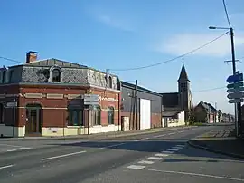 The centre of Le Sars | |
 Coat of arms | |
Location of Le Sars | |
 Le Sars 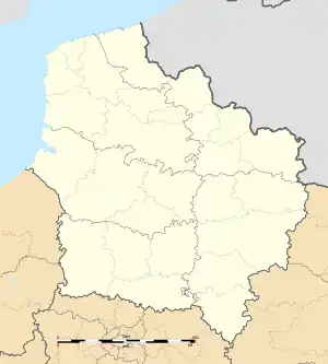 Le Sars | |
| Coordinates: 50°04′18″N 2°46′53″E | |
| Country | France |
| Region | Hauts-de-France |
| Department | Pas-de-Calais |
| Arrondissement | Arras |
| Canton | Bapaume |
| Intercommunality | CC Sud-Artois |
| Government | |
| • Mayor (2020–2026) | Denis Basseux[1] |
| Area 1 | 5.11 km2 (1.97 sq mi) |
| Population (2021)[2] | 158 |
| • Density | 31/km2 (80/sq mi) |
| Time zone | UTC+01:00 (CET) |
| • Summer (DST) | UTC+02:00 (CEST) |
| INSEE/Postal code | 62777 /62450 |
| Elevation | 96–133 m (315–436 ft) (avg. 121 m or 397 ft) |
| 1 French Land Register data, which excludes lakes, ponds, glaciers > 1 km2 (0.386 sq mi or 247 acres) and river estuaries. | |
Geography
Le Sars is situated 16 miles (26 km) south of Arras, at the junction of the D11 and the D929 roads.
Population
| Year | Pop. | ±% p.a. |
|---|---|---|
| 1968 | 211 | — |
| 1975 | 178 | −2.40% |
| 1982 | 166 | −0.99% |
| 1990 | 163 | −0.23% |
| 1999 | 172 | +0.60% |
| 2007 | 176 | +0.29% |
| 2012 | 167 | −1.04% |
| 2017 | 180 | +1.51% |
| Source: INSEE[4] | ||
Places of interest
- The church of St.Pierre, rebuilt along with the rest of the village, after World War I.
References
- "Répertoire national des élus: les maires". data.gouv.fr, Plateforme ouverte des données publiques françaises (in French). 2 December 2020.
- "Populations légales 2021". The National Institute of Statistics and Economic Studies. 28 December 2023.
- INSEE commune file
- Population en historique depuis 1968, INSEE
Wikimedia Commons has media related to Le Sars.
This article is issued from Wikipedia. The text is licensed under Creative Commons - Attribution - Sharealike. Additional terms may apply for the media files.