Autingues
Autingues (French pronunciation: [otɛ̃ɡ]) is a commune in the Pas-de-Calais department in northern France.[3]
Autingues | |
|---|---|
_mairie.JPG.webp) The town hall of Autingues | |
 Coat of arms | |
Location of Autingues | |
 Autingues 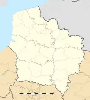 Autingues | |
| Coordinates: 50°50′19″N 1°58′45″E | |
| Country | France |
| Region | Hauts-de-France |
| Department | Pas-de-Calais |
| Arrondissement | Calais |
| Canton | Calais-2 |
| Intercommunality | CC Pays d'Opale |
| Government | |
| • Mayor (2020–2026) | Blaise de Saint-Just d'Autingues[1] |
| Area 1 | 2.97 km2 (1.15 sq mi) |
| Population (2021)[2] | 287 |
| • Density | 97/km2 (250/sq mi) |
| Time zone | UTC+01:00 (CET) |
| • Summer (DST) | UTC+02:00 (CEST) |
| INSEE/Postal code | 62059 /62610 |
| Elevation | 4–45 m (13–148 ft) (avg. 21 m or 69 ft) |
| 1 French Land Register data, which excludes lakes, ponds, glaciers > 1 km2 (0.386 sq mi or 247 acres) and river estuaries. | |
Geography
A village located 10 miles (16 km) southeast of Calais, at the junction of the D225 with the D227 road.
Population
| Year | Pop. | ±% p.a. |
|---|---|---|
| 1968 | 182 | — |
| 1975 | 223 | +2.94% |
| 1982 | 230 | +0.44% |
| 1990 | 224 | −0.33% |
| 1999 | 255 | +1.45% |
| 2009 | 302 | +1.71% |
| 2014 | 288 | −0.94% |
| 2020 | 288 | +0.00% |
| Source: INSEE[4] | ||
Sights
- The eighteenth-century church of St. Louis.
- The eighteenth-century château.
References
- "Répertoire national des élus: les maires". data.gouv.fr, Plateforme ouverte des données publiques françaises (in French). 2 December 2020.
- "Populations légales 2021". The National Institute of Statistics and Economic Studies. 28 December 2023.
- INSEE commune file
- Population en historique depuis 1968, INSEE
Wikimedia Commons has media related to Autingues.
This article is issued from Wikipedia. The text is licensed under Creative Commons - Attribution - Sharealike. Additional terms may apply for the media files.