Boiry-Saint-Martin
Boiry-Saint-Martin (French pronunciation: [bwaʁi sɛ̃ maʁtɛ̃]) is a commune in the Pas-de-Calais department in the Hauts-de-France region in northern France.[3]
Boiry-Saint-Martin | |
|---|---|
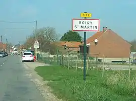 The road into Boiry-Saint-Martin | |
 Coat of arms | |
Location of Boiry-Saint-Martin | |
 Boiry-Saint-Martin 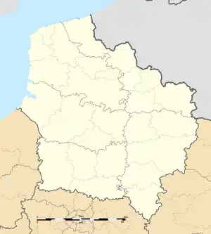 Boiry-Saint-Martin | |
| Coordinates: 50°12′00″N 2°45′37″E | |
| Country | France |
| Region | Hauts-de-France |
| Department | Pas-de-Calais |
| Arrondissement | Arras |
| Canton | Avesnes-le-Comte |
| Intercommunality | CU Arras |
| Government | |
| • Mayor (2020–2026) | Cédric Delmotte[1] |
| Area 1 | 3.5 km2 (1.4 sq mi) |
| Population (2021)[2] | 263 |
| • Density | 75/km2 (190/sq mi) |
| Time zone | UTC+01:00 (CET) |
| • Summer (DST) | UTC+02:00 (CEST) |
| INSEE/Postal code | 62146 /62175 |
| Elevation | 79–122 m (259–400 ft) (avg. 80 m or 260 ft) |
| 1 French Land Register data, which excludes lakes, ponds, glaciers > 1 km2 (0.386 sq mi or 247 acres) and river estuaries. | |
Geography
A farming village located 7 miles (11 km) south of Arras on the D32 road.
Population
| Year | Pop. | ±% p.a. |
|---|---|---|
| 1968 | 289 | — |
| 1975 | 289 | +0.00% |
| 1982 | 276 | −0.66% |
| 1990 | 275 | −0.05% |
| 1999 | 281 | +0.24% |
| 2009 | 294 | +0.45% |
| 2014 | 280 | −0.97% |
| 2020 | 268 | −0.73% |
| Source: INSEE[4] | ||
Sights
- The church of St. Martin, rebuilt after the destruction of the village during World War I.
References
- "Répertoire national des élus: les maires". data.gouv.fr, Plateforme ouverte des données publiques françaises (in French). 9 August 2021.
- "Populations légales 2021". The National Institute of Statistics and Economic Studies. 28 December 2023.
- INSEE commune file
- Population en historique depuis 1968, INSEE
Wikimedia Commons has media related to Boiry-Saint-Martin.
This article is issued from Wikipedia. The text is licensed under Creative Commons - Attribution - Sharealike. Additional terms may apply for the media files.