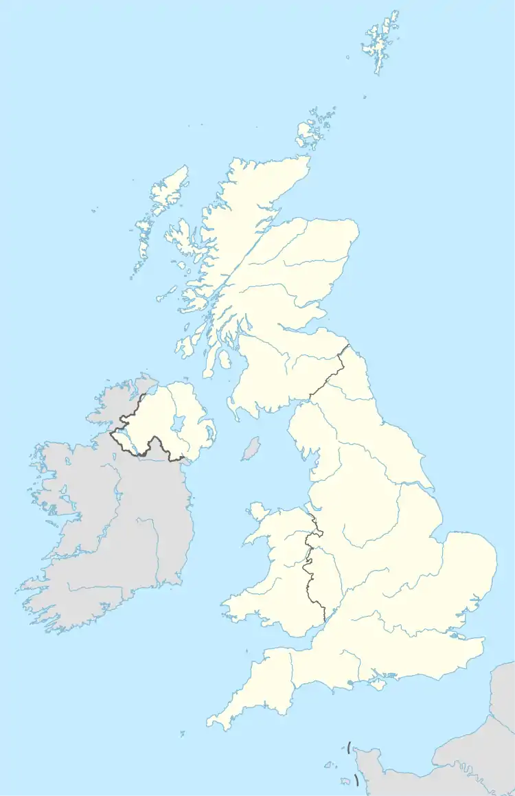
LA postcode area
The LA postcode area, also known as the Lancaster postcode area,[2] is a group of 23 postcode districts in north-west England, within 17 post towns. These cover north Lancashire (including Lancaster, Morecambe and Carnforth) and southern Cumbria (including Barrow-in-Furness, Kendal, Ulverston, Windermere, Dalton-in-Furness, Milnthorpe, Sedbergh, Grange-over-Sands, Askam-in-Furness, Kirkby-in-Furness, Broughton-in-Furness, Coniston and Ambleside and Millom), and part of North Yorkshire.
Template:Attached KML/LA postcode area
KML is from Wikidata
Lancaster | |
|---|---|
 LA | |
| Coordinates: 54.173°N 2.907°W | |
| Country | United Kingdom |
| Postcode area | LA |
| Postcode area name | Lancaster |
| Post towns | 17 |
| Postcode districts | 23 |
| Postcode sectors | 66 |
| Postcodes (live) | 11,800 |
| Postcodes (total) | 14,678 |
| Statistics as at May 2020[1] | |
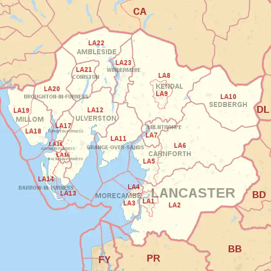
Coverage
The approximate coverage of the postcode districts:
| Postcode district | Post town | Coverage | Local authority area(s) |
|---|---|---|---|
| LA1 | LANCASTER | Lancaster, Aldcliffe, Bailrigg | City of Lancaster |
| LA2 | LANCASTER | Lancaster, Abbeystead, Aldcliffe, Aughton, Austwick, Bailrigg, Bay Horse, Caton, Clapham, Cockerham, Dolphinholme, Ellel, Farleton, Galgate, Glasson Dock, Halton, Hest Bank, High Bentham, Hornby, Quernmore, Tatham, Wharfe | City of Lancaster, North Yorkshire, Wyre |
| LA3 | MORECAMBE | Morecambe, Heysham, Middleton, Overton, Sunderland Point | City of Lancaster |
| LA4 | MORECAMBE | Morecambe, Torrisholme | City of Lancaster |
| LA5 | CARNFORTH | Carnforth, Arnside, Silverdale, Warton, Bolton-Le-Sands | City of Lancaster, Westmorland and Furness |
| LA6 | CARNFORTH | Arkholme, Burton-in-Kendal, Burton in Lonsdale, Cantsfield, Casterton, Ingleton, Ireby, Kirkby Lonsdale, Masongill, Tunstall, Whittington | City of Lancaster, North Yorkshire, Westmorland and Furness |
| LA7 | MILNTHORPE | Milnthorpe, Beetham, Storth, Heversham | Westmorland and Furness |
| LA8 | KENDAL | Brigsteer, Grayrigg, Levens, Sedgwick, Sizergh | Westmorland and Furness |
| LA9 | KENDAL | Kendal, Burneside, Natland, Oxenholme | Westmorland and Furness |
| LA10 | SEDBERGH | Sedbergh, Dent | Westmorland and Furness, North Yorkshire |
| LA11 | GRANGE-OVER-SANDS | Grange-over-Sands, Allithwaite, Cark, Cartmel, Field Broughton, High Newton, Lindale, Low Newton, Meathop and Ulpha, Witherslack | Westmorland and Furness |
| LA12 | ULVERSTON | Ulverston, Aldingham, Backbarrow, Gleaston, Graithwaite, Haverthwaite, Leece, Lindal-in-Furness, Newbiggin (Furness), Newby Bridge, Staveley-in-Cartmel, Urswick | Westmorland and Furness |
| LA13 | BARROW-IN-FURNESS | Barrow-in-Furness (east), Newton-in-Furness, Piel Island, Rampside, Roa Island, Roose, Stainton with Adgarley | Westmorland and Furness |
| LA14 | BARROW-IN-FURNESS | Barrow-in-Furness (west), Walney Island | Westmorland and Furness |
| LA15 | DALTON-IN-FURNESS | Dalton-in-Furness | Westmorland and Furness |
| LA16 | ASKAM-IN-FURNESS | Askam-in-Furness | Westmorland and Furness |
| LA17 | KIRKBY-IN-FURNESS | Kirkby-in-Furness | Westmorland and Furness |
| LA18 | MILLOM | Millom | Cumberland |
| LA19 | MILLOM | Waberthwaite, Bootle | Cumberland |
| LA20 | BROUGHTON-IN-FURNESS | Broughton-in-Furness | Westmorland and Furness |
| LA21 | CONISTON | Coniston, Torver | Westmorland and Furness |
| LA22 | AMBLESIDE | Ambleside, Chapel Stile, Elterwater, Grasmere, Hawkshead, Near Sawrey, Skelwith Bridge | Westmorland and Furness |
| LA23 | WINDERMERE | Windermere, Bowness-on-Windermere, Troutbeck | Westmorland and Furness |
Map
Template:Attached KML/LA postcode area
KML is from Wikidata
References
- "ONS Postcode Directory Version Notes" (ZIP). National Statistics Postcode Products. Office for National Statistics. May 2020. Table 2. Retrieved 19 June 2020. Coordinates from mean of unit postcode points, "Code-Point Open". OS OpenData. Ordnance Survey. February 2012. Retrieved 21 April 2012.
- Royal Mail, Address Management Guide, (2004)
External links
This article is issued from Wikipedia. The text is licensed under Creative Commons - Attribution - Sharealike. Additional terms may apply for the media files.